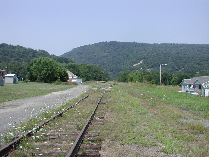
 [Aug 2002] Main line at Robertsdale looking southbound towards Robertsdale Station. Mine #1 tipple was about Ľ mile beyond the station. |
 [Aug 2002] Robertsdale Station. This building is now leased by the Friends of the East Broad Top and is the location of their museum and gift shop. |
 [Aug 2002] RI&C Company Post Office at Robertsdale, now owned by the Friends of the East Broad Top. |
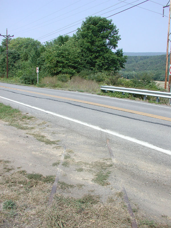
 [Aug 2002] Rt. 913 grade crossing at Robertsdale, northbound view |
 [Aug 2002] Site of RI&C Company Store, Robertsdale. This historic building was demolished in 1997. |
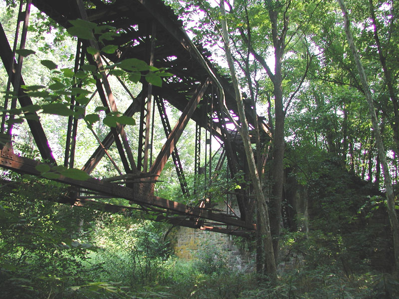
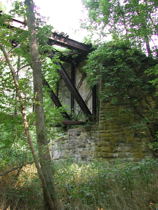
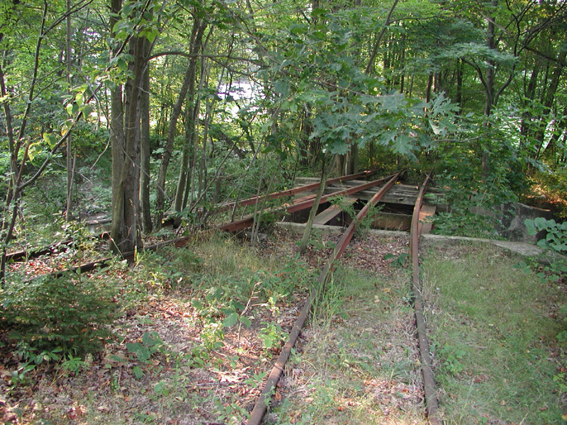 [Aug 2002] Wye tail switch and bridge at Robertsdale. |
 [Aug 2002] Robertsdale wye track with and Post Office. |
 [Aug 2002] Another view of the Robertsdale Post Office. |
 [Aug 2002] The main line along Rt. 3019 between Robertsdale and Cooks, northbound view |
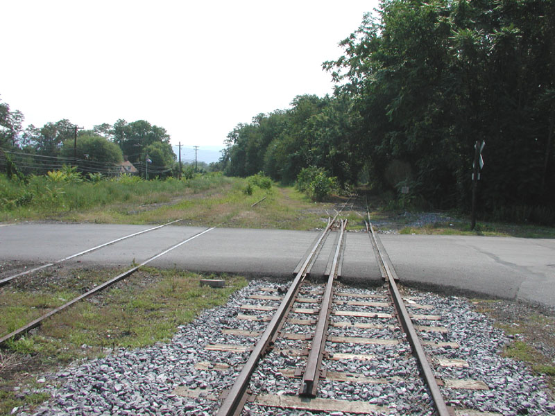
 [Aug 2002] At Cooks, Rt. 3019 meets Rt. 994, and we turn right. Immediately after the turn, we encounter the EBT main line grade crossing, northbound view. |
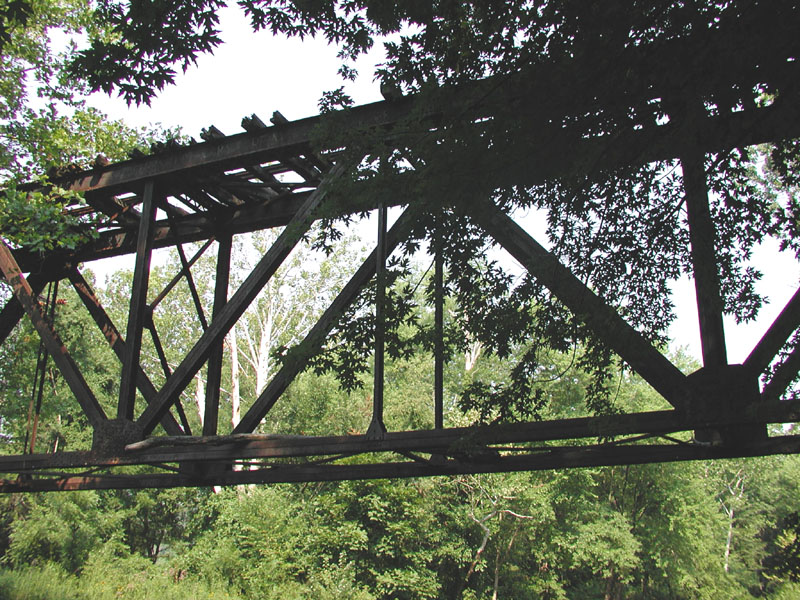
 [June 2005] Then back to Rt. 3019 north, we hike to Rocky Ridge. Truss bridge at Rocky Ridge |
 [June 2005] Truss bridge at Rocky Ridge |
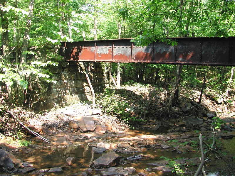 [June 2005] Truss bridge at Rocky Ridge |
 [June 2005] The remains of Rocky Ridge station |
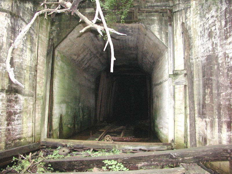
 [June 2005] South portal of Wray's Hill tunnel at Rocky Ridge |
 [June 2005] The tunnel portal is blocked by a roof fall. VERY DANGEROUS! DO NOT ENTER! |
 [June 2005] The siding at Rocky Ridge. |
 [June 2004] The grade crossing at Coles Valley Road. |
 [June 2004] We hike along the track to the water tank at Coles. |
 [June 2004] The Coles water tank is the last surviving water tank on the EBT RR. |
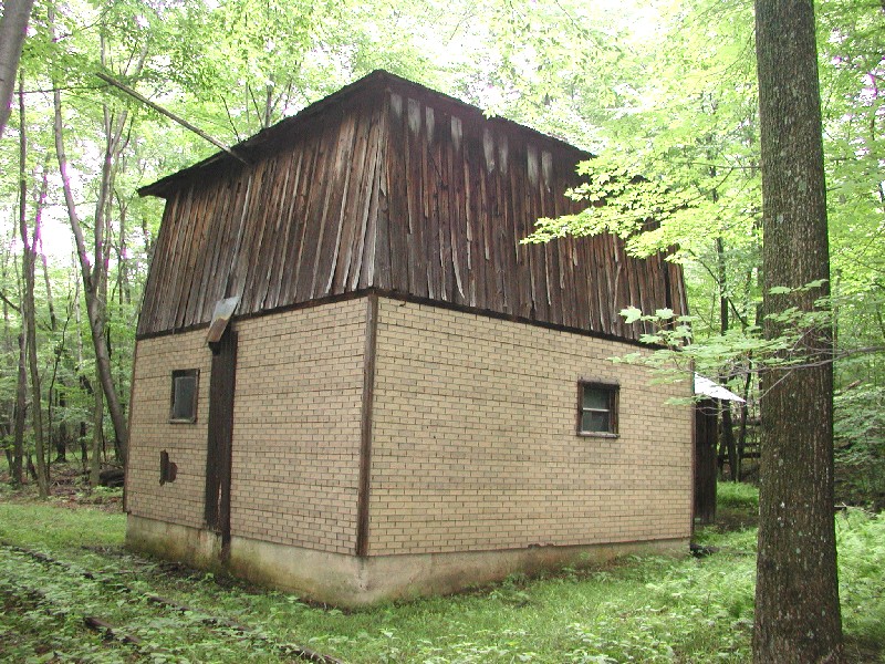 [June 2004] The tank structure is still relatively intact. |
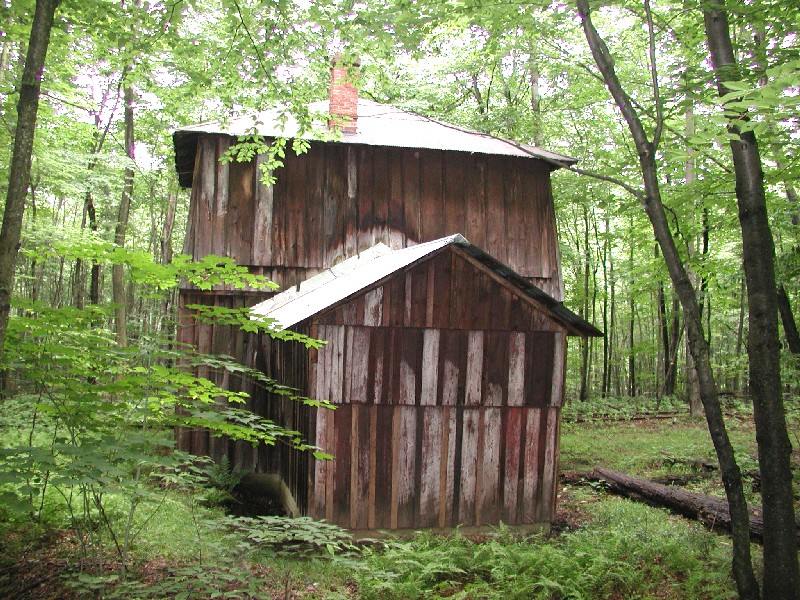 [June 2004] Back side view of the tank. |
 [June 2004] Interior of the first floor, showing heavy beams supporting the water tank above. |
 [Aug 2002] Southbound end of Kimmel passing siding, northbound view. |
 [Aug 2002] Kimmel Rt. 994 grade crossing, southbound view towards siding |
 [Aug 2002] Kimmel Rt. 994 grade crossing, northbound view. Note newly-installed guardrail. |
 [Aug 2002] EBT main line southbound exiting Sideling Hill Tunnel, view towards Kimmel. |
 [Aug 2002] Southbound portal of Sideling Hill Tunnel. VERY DANGEROUS! DO NOT ENTER! |
 [Aug 2002] Rt. 994 grade crossing near Fairview, southbound view towards Sideling Hill tunnel. |
 [June 2004] North portal of Sideling Hill tunnel. |
 [June 2004] North portal of Sideling Hill tunnel. VERY DANGEROUS! DO NOT ENTER! |
 [June 2004] The main line grade crossing at Old Mill Road just north of Saltillo |
 [June 2004] The north leg of the Saltillo wye crossing Old Mill Road. The tail of the wye used to be in the field on the left, but the rails have been taken up by the property owner. |
 [Aug 2002] Concrete foundation of Saltillo water tank and steel girder bridge, southbound view. |
 [Aug 2002] Concrete foundation of Saltillo water tank, northbound view. |
 [Aug 2002] The main line at Saltillo water tank, northbound view. |
 [Aug 2002] Steel girder bridge by Saltillo water tank. |
 [Aug 2002] Details of girder bridge by Saltillo water tank. NO TRESPASSING! |
 [Aug 2002] The La Palace Hotel at Saltillo. |
 [Aug 2002] Saltillo Station |
 [Aug 2002] Another view of Saltillo Station |
 [June 2005] Too badly deteriorated to save, Saltillo Station was demolished in December 2004 |
 [Aug 2002] The Freight House at Three Springs. |
 [Aug 2002] Another view of the Freight House at Three Springs. |
 [Aug 2002] Rt. 994 grade crossing at Three Springs, southbound view. |
 [Aug 2002] Rt. 994 grade crossing at Three Springs, northbound view. |
 [Aug 2002] The main line at the Three Springs municipal pool, northbound view. |
 [Aug 2002] Rt. 2005 grade crossing at Three Springs, northbound view. |
 [Aug 2002] A closer view of the Rt. 2005 grade crossing at Three Springs, northbound view. |
 [Aug 2002] The EBT main line runs across the back yard of a private residence at the northbound side of Rt. 2005 grade crossing in Three Springs. |
 [Aug 2002] Rt. 994 grade crossing on the eastern outskirts of Three Springs, southbound view back towards Three Springs. |
 [Aug 2002] Rt. 994 grade crossing on the eastern outskirts of Three Springs, northbound view towards Pogue. |
 [Aug 2002] Standing on the main line at the south end of Pogue Bridge, looking northbound across bridge. VERY DANGEROUS! NO TRESPASSING ON BRIDGE! |
 [Aug 2002] Another view of the south end of Pogue Bridge, looking northbound. |
 [Aug 2002] Detail of the south pier of Pogue Bridge. Note the tree growing out of the pier - will this cause the pier and bridge to collapse in a few years? |
 [Aug 2002] Pogue Bridge south truss detail. Note the large tree branch laying across the bottom girders. |
 [Aug 2002] Pogue Bridge detail |
 [Aug 2002] Pogue Bridge detail |
 [Aug 2002] Pogue Bridge detail |
 [Aug 2002] Pogue Bridge detail |
 [Aug 2002] North truss of Pogue Bridge, underneath detail |
 [Aug 2002] Pogue Bridge detail |
 [Aug 2002] North pier Pogue Bridge detail |
 [Aug 2002] North end of Pogue Bridge by the So. Huntington Co. High School, southbound view across bridge. VERY DANGEROUS! DO NOT TRESPASS ON BRIDGE! |
 [Aug 2002] The EBT main line crosses the front lawn of the High School, northbound view. |
 [Aug 2002] The Rt. 994 grade crossing just north of the High School, southbound view towards High School. |
 [Aug 2002] The Rt. 994 grade crossing just north of the High School, northbound view towards Jordan Summit. |
 [Aug 2002] Overpass at Jordan Summit, northbound view towards Rockhill Furnace. |
 [Aug 2002] The former EBT RR President’s mansion at Rockhill Furnace is now an American Legion meeting hall. The EBT Rockhill Furnace Yards are just beyond and below the line of trees behind the building. |
 [Aug 2002] The EBT main line passes through the Baptist Cemetary on the north side of Shirleysburg, northbound view. |
 [Aug 2002] The new Rt. 522 overpass north of Shirleysburg, southbound view. |
 [April 2002] The Aughwick Creek concrete arch bridge. |
 [Aug 2002] The EBT main line near Riverview Industrial Park, northbound view. |
 [Aug 2002] The main line by a Nascar souvenier shop, Adams, southbound view. |
 [Aug 2002] At the Rt. 103 intersection, we see a sign advertising the EBT, with dual-gauge rails in the foreground, southbound view. |
 [June 2005] A stretch of track in Allenport, restored by the Mt. Union Connecting RR |
 [Aug 2002] The new Rt. 522 grade crossing at Allenport, southbound view. |
 [Aug 2002] The Rt. 522 grade crossing at Allenport, northbound view. |
 [Aug 2002] Closeup of rail transition at south side of Rt. 522 grade crossing. 132 lb. rail is buried within the crossing, connecting to the EBT's 100 lb. mainline rail. |
 [Aug 2002] Rt. 522 grade crossing at Allenport, northbound view showing the Mt. Union yard and hoppers in distance. |
 [Aug 2002] The Mt. Union Engine House. EBT standard-gauge switch engine #3 still waits in the right-side stall; the left-side stall is cleared to house the MCR diesel. |
 [Aug 2002] Mt. Union Franklin St. grade crossing, southbound view towards EBT yards. |
 [Aug 2002] Mt. Union Franklin St. grade crossing, northbound view. Narrow gauge rail currently ends several hundred feet beyond this point. |
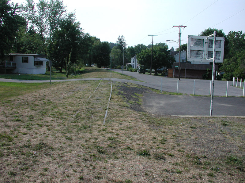
 [June 2005] Site of the EBT RR passenger station in Mt. Union. The station was torn down soon after the EBT closed down and now a vetenerinan's office occupies the site. |
 [Aug 2002] This building is the former Pennsylvania RR freight station. |
 [Aug 2002] Mt. Union Jefferson St. grade crossing, northbound view towards new MCR loading dock and connection with standard-gauge main line. |